West Highland Way: Trailblazer Ochils and Campsie Fells

 Bearsden & District

Lennoxtown - Blairskaith

West Highland Way - Map West Highland Way: Footprint Map


Photographs of a circular country walk from Lennoxtown through Lennox Forest
 to Blairskaith Muir with views of the Campsie Fells
descending to East Blairskaith Farm and returning by the Mealybrae Path.

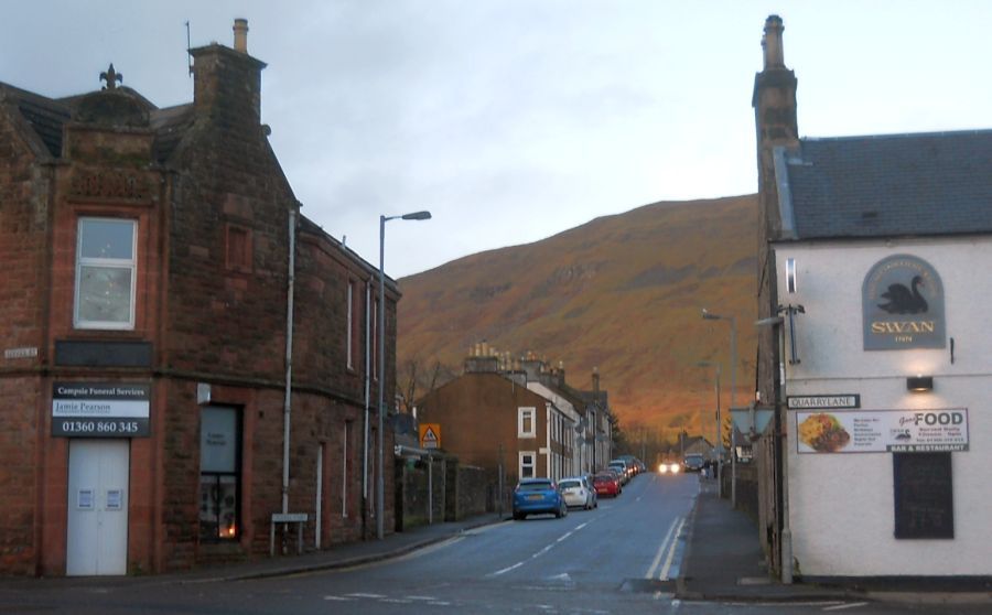
Lennoxtown beneath the Campsie Fells
Lennoxtown beneath the Campsie Fells


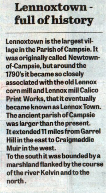
Lennoxtown info


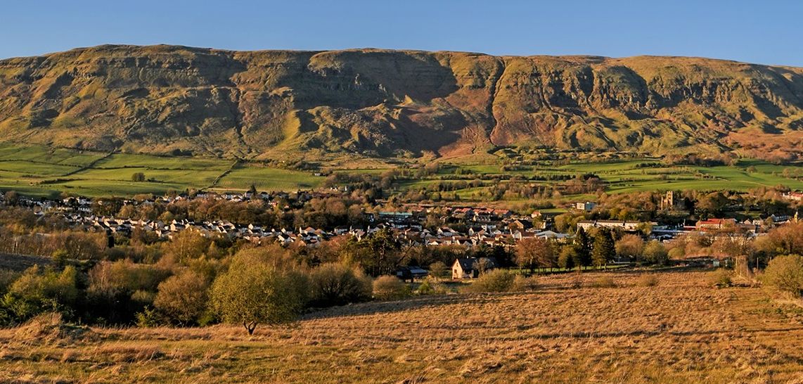
Lennoxtown beneath the Campsie Fells


Lennoxtown beneath the Campsie Fells
Lennoxtown beneath the Campsie Fells


Sign at Lennox Forest above Lennoxtown

Sign at Lennox Forest above Lennoxtown


lennoxtown.htm

Lennox Forest


Campsie Fells beyond signpost on Blairskaith Muir


Campsie Fells from trig point on Blairskaith Muir


Path from Blairskaith Muir to East Blairskaith Farm


East Blairskaith Farm

East Blairskaith Farm


Blairskaith House

Blairskaith House


Lennoxtown beneath Cort-ma Law on the Campsie Fells
Mealybrae Path from Blairskaith to Lennox Forest


Kilpatrick Hills from the Mealybrae Path

Kilpatrick Hills from the Mealybrae Path


Mealybrae Path to Lennox Forest

Mealybrae Path to Lennox Forest


Road from Lennox Forest to Lennoxtown

Road from Lennox Forest to Lennoxtown


Crow road over the Campsie Fells from Lennoxtown

Crow road over the Campsie Fells from Lennoxtown


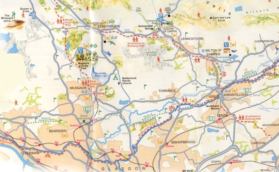
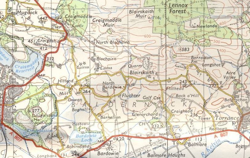
Map of Lennoxtown and Lennox Forest

Map of Lennoxtown and Lennox Forest


Map of Lennox Forest and Blairskaith

Map of Lennox Forest and Blairskaith


LENNOXTOWN CIRCULAR WALK - ROUTE DESCRIPTION:

Our walk is a lovely circular 7.5 mile stroll from Lennoxtown which offcrs great variety in the surrounding countryside.
It starts at the Memorial Hall on Main Street and from there climbs a brae to the south of the town until it reaches a ridge.
The brae is steep. The tarred road then bends to the right past Muirhead Farm and brings you to the Lennox Forest and to a small car park where, if you want, you can shorten the walk. Follow the track straight on past the car park.
Descend an incline where the track divides and if you continue straight ahead you find yourself walking between tall conifers until you emerge on to moor. On your right you will see a trig beacon about 100 metres off to your right and accessed by a stile. At 218 metres it is the highest point on thewalk with views to the north of the Arrochar Alps and Ben Lomond.
2oo metres beyond the path to the trig beacon the track takes a sharp bend to the left going downhill.
At its foot, having gone through a couple of metal gates, you turn right along a rough metalled track with a disused quarry on your right and another on your left.
On your left you will pass a couple of beaten-up vehicles and a shack before turning left and continuing downhill on a well surfaced track to East Blairskaith Farm. Follow the access road to  the farm and onto Tower Road.
lf you don't relish the next wet stretch, turn back and retrace your steps -in doing so you will enjoy different views to those on the outgoing section.
If you are wearing watertight boots and carrying a walking stick or pole, you may wish to continue along Tower Road to the first crossroad, Turn left here up a tarred road which ends at a private road to a house.
To your right is a track,
the Mealybrae Path, once cobbled, but now sorely neglected.  ln wet periods ( ie most of autumn and winter ) this track is running with water although the surface is firm though slippery. The banks on each side hem you in — was this an old drover's path?
The path ascends quite steeply until eventually you reach a metal gate and a stile.
Continue along the track which is now more level, but more boggy, although you can see cobble stones beneath the grass.
Cross a small burn on the stepping stones, across another stile until the track swings to the left uphill, a stand of conifers on your left and replanted forest on your right. Ignore a new track to your right and go on uphill to the main track where you tum right, soon arriving at the car park again. Then retrace your steps back to the start and enjoy the luxury of walking downhill with some great views over Lennoxtown and the Campsies .


Lennox-Blairskaith Gallery Photo Gallery :: Lennoxtown Gallery Photo Gallery :: Campsie Fells Gallery Photo Gallery

<< Back : Bearsden Walks Index : Next >>


Scotland Index :: Scottish Peaks :: Scotland Walks

Glencoe | Ben Nevis | Knoydart | Isle of Skye | Isle of Arran

The Eastern Highlands | The Central Highlands | The Southern Highlands | The NW Highlands


Adventure Travel : Worldwide Mountaineering : Site Index

fb icon  google+ icon Linkedin icon  twitter


Guide Books & Maps - Scotland:-


West Highland Way: Footprint MapWest Highland Way - Map West Highland Way - Map Western Scotland & the Western Isles OS Road Map Northern Scotland OS Road MapSouthern Scotland OS Road MapGlasgow Popular Hills - Map


Ochils and Campsie Fells

Glasgow Visitor Guide - Colin Baxter Itchy Insider's Guide to Glasgow Glasgow Footprint Pocket Guide Glasgow Insight Pocket Guide Glasgow Guide Pub Companion Glasgow Scotland's Highlands & Islands - Rough Guide Scotland - Rough Guide

Glasgow Insight Pocket GuideCollins Street Map of GlasgowGlasgow: Then & NowThey belonged to Glasgow Phillips Street Atlas of Glasgow & West Central Scotland Glasgow: The Photographic Atlas100 Hillwalks around Glasgow 50 Walks in Glasgow & SW Scotland

Visit Scotland - Touring Guide Scotland: Where to Stay - Hotels & Guest Houses Scotland: Where to Stay - Bed & Breakfast Rough Guide ScotlandScottish Highlands & Islands - Rough Guide Scotland - Lonely PlanetScotland's Highlands & Islands - Lonley Planet Great Glasgow StoriesGlasgow & Surroundings - Insight Guide

West Highland Way: Official GuideWest Highland Way: Rucksac ReadersWest Highland Way: TrailblazerThe West Highland WayWest Highland Way: Footprint MapWest Highland Way - Map West Highland Way - Map West Highland Way Wet Highland Way - Official Guide

Munro Almanac The High Mountains of Britain and Ireland The Munros: Scottish Mountaineering Club The Isle of Skye The Isle of Arran Wilderness Walks Ski Mountaineering in Scotland

More Wilderness Walks 50 Best Routes on Skye and Raasay Skye - W.A.PoucherMagic of the Munros Mountaineering in Scotland and Undiscovered Scotland by W.H.MurrayA Long Walk on the Isle of Skye

Classic Climbs - Central & Southern Highlands The Isle of Arran Lonely Planet, Walking in ScotlandPathfinder Guide: Skye and NW Highlands WalksPathfinder Guide: Fort William and Glen Coe Walks Rambler's Guide: Ben Nevis and Glen Coe50 Best Routes on Skye and Raasay - Chris Townsend


Google Analytics


Google Analytics

extremetracking
 eXTReMe Tracker


extremetracking
Sitelock caingram.com
SiteLock
Sitelock
Sitelock caingram.info
SiteLock
Sitelock